AeroPic

Shropshire Castles

ehgp.com


Here's a small collection of aerial photos of castles, old churches, ruins and other ancient attractions in Shropshire.

Battlefield Church

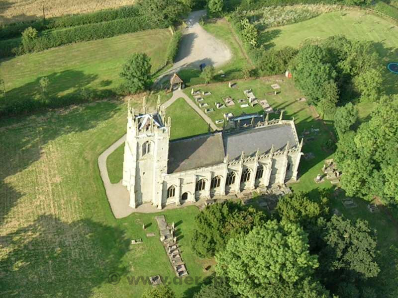
Battlefield Church

Shrewsbury, Shropshire, England  Map

Built in 1406 to commemorate the Battle of Shrewsbury in 1403. The church lies to the north of Shrewsbury in open countryside next to the site of the battle.
Haughmond Abbey

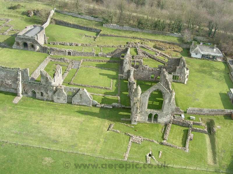
Haughmond Abbey

Shrewsbury, Shropshire, England  Map

The extensive remains of an Augustinian abbey found in the 12th Century, including remains of the Abbots' quarters, refectory and cloister. The Abbey was finally dissolved in 1539 during the Dissolution of the Monasteries by Henry VIII and fell into ruin.
Moreton Corebet Castle

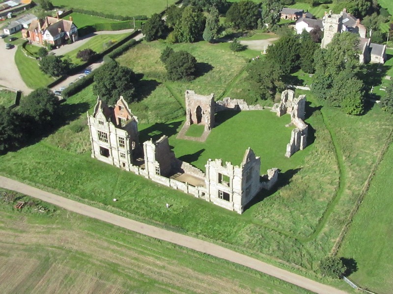
Moreton Corbet Castle

Near Shrewsbury, Shropshire, England  Map

The ruins of a 500 year old castle and Tudor manor house, devastated during the English Civil War.
Old Oswestry Hill Fort

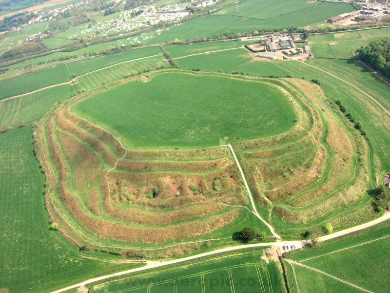
Old Oswestry Hill Fort

Oswestry, Shropshire, England  Map

Known as "Caer Ogyrfan" this Iron Age fort covers over forty acres with the remains of elaborate defenses. It is said to be the birthplace of Queen Guinevere and the site for the final battle of King Cynddylan.
Shrewsbury Castle

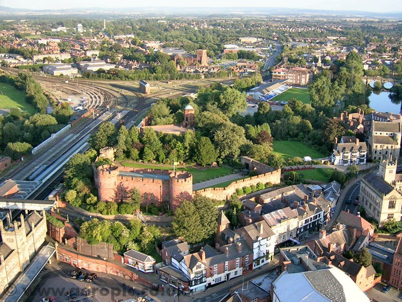
Shrewsbury Castle

Shrewsbury, Shropshire, England  Map

The castle dates back to 1066 and the reign of William the Conqueror, and has been significantly modified over the centuries. To the left of the photo is Shrewsbury Railway Station and in the background the River Severn.
St Chad's, Shrewsbury

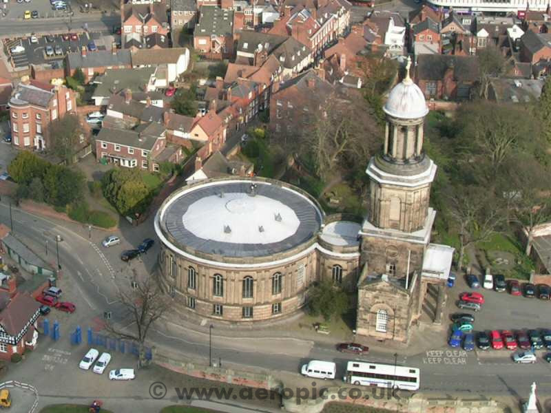
St Chad's

Shrewsbury, Shropshire, England  Map

Completed in 1792, St Chad's Church is quite unusual with its 150 foot circular nave and 150 foot tower. The tower contains 12 bells, the heaviest of which weighs almost two tons.
Stokesay Castle

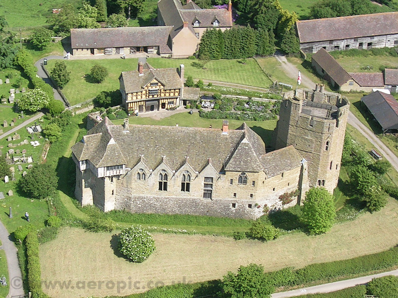
Stokesay Castle

Carven Arms, Shropshire, England  Map

A 13th century manor house set in a wooden valley in south Shropshire.
Whittington Castle

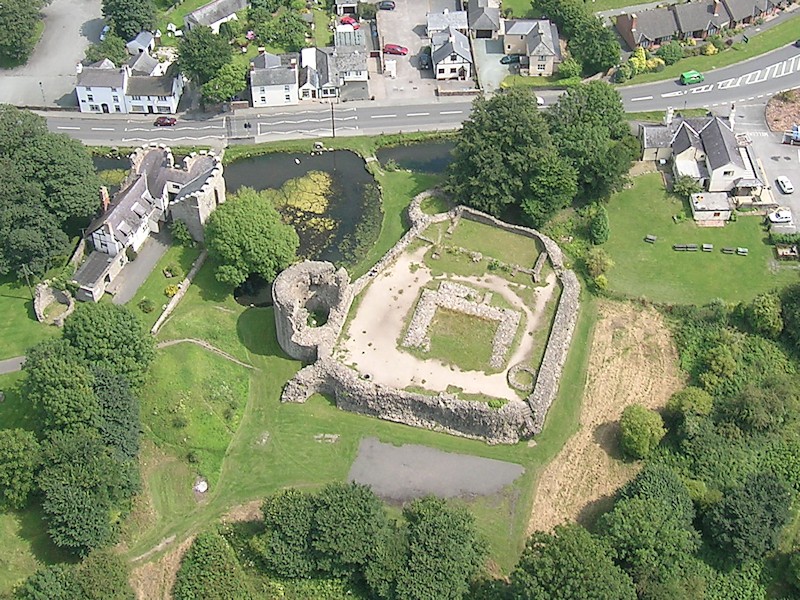
Whittington Castle

Whittington, Shropshire, England  Map
These ruins date from about 1221. The castle fell into decay after the English Civil War and the remains were subsequently plundered for stone to surface roads and build local houses.
The Wrekin

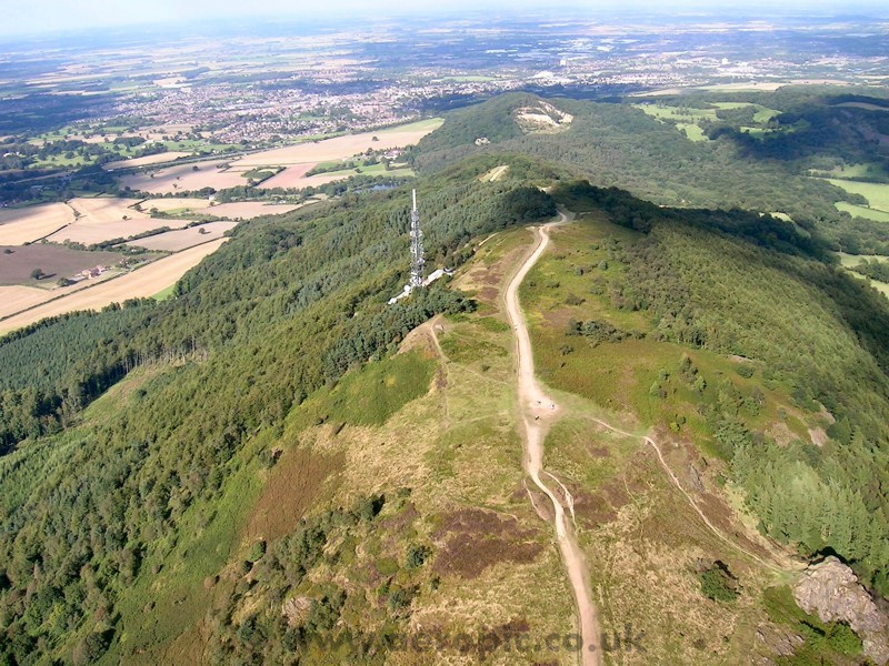
The Wrekin

Shropshire, England  Map
Climbing to 1000 feet above the Shropshire countryside, and the site of an Iron Age hill fort believed to have been the headquarters of the pre-Roman Cornovii tribe. The fort was captured and destroyed by the Romans in about AD49.
Wroxeter

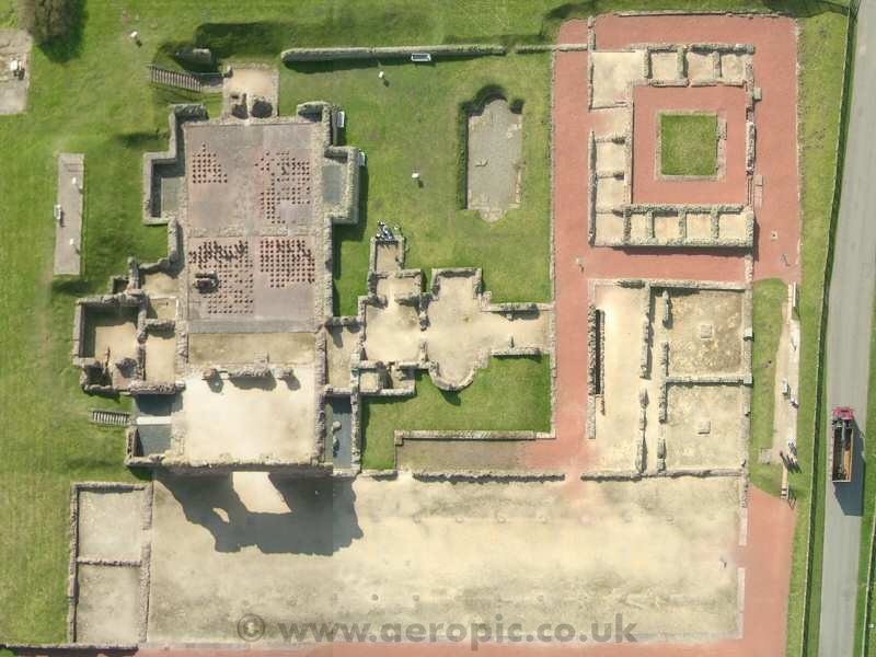
Wroxeter Roman City

Shropshire, England  Map

Wroxeter ('Viroconium') was the fourth largest city in Roman Britain. It began as a legionary fortress and developed into a thriving civilian city. Shown here are the remains of the 2nd century municipal baths.

All images are © Copyright E Penman 2003-2013
Top    ehgp.com     Home